SkyView in the WWT

The release of Microsoft’s WorldWideTelescope this week made a big splash with articles in the New York Times and other media. It’s a very nice interface where you can just zoom and pan and compare data in a very elegant fashion. The ability to build tours of the sky is amazing.

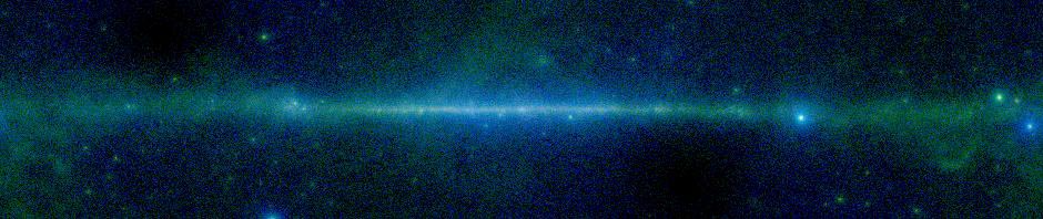
When they look inside the hood of the WWT, SkyView users may find a lot of stuff that looks familiar. Most of the survey images in the initial release of WWT were taken from SkyView. The TOAST projection was added to SkyView to help support the WWT’s ingest of many of our most popular surveys.

We are very pleased to have been able to play a role in the WWT. We anticipate closer integration of SkyView and this kind of interface (WWT, GoogleSky, sky-map.org) in the future. The unprecedented ability to rapidly browse the entire survey nicely complements SkyView’s ability to create precisely tailored images. SkyView’s role as an archive for multi-wavelength survey data remains unparalleled and should be strengthened with the release of our publication interface.

Congratulations to the WWT team.

Posted in Discussion, Notices | Tagged | 4 Comments

Duplicate EPOCHs in GALEX data

If you’ve tried the new GALEX survey from the command line, you may have noticed some messages

Warning: Multiple occurrences of key: EPOCH

popping up. Many of the GALEX FITS files have two EPOCH keywords in their headers. Fortunately they both have the same value, so this is innocuous enough. Still the FITS reader gets a bit nervous when it sees this.

It’s a little more embarrassing since the EPOCH keyword is deprecated in FITS. Epoch usually means the time of the observation, but it was explicitly defined to be the epoch of the coordinate system in the original FITS definition. To relieve the confusion this engendered EPOCH was deprecated. We’re supposed to use EQUINOX for the epoch of the coordinate system and DATE-OBS for the epoch of the observatoin.

So having even one EPOCH keyword is bad form much less two!

Posted in Discussion | Tagged , | Leave a comment

Corrected Astrometry for DSS Plates

We’ve updated the astrometry for two DSS plates: XJ643 and XP338. These are at RA,Dec of 180.62,14.74 and 282.84,40.08 in the DSS2 Blue and Red respectively. Thanks to Sergei Goshko at sky-map.org for pointing out the discrepancies.

Posted in Notices | Tagged , | Leave a comment

New ImageFinders and Faster FITS

The GALEX release was accompanied by a few other changes. The one that some users may notice is that for surveys where the data is gzip compressed, SkyView should be a little faster. SkyView was sometimes reading the entire image when it only needed to read the FITS headers.

To support the GALEX survey the image finder code in SkyView was updated. In SkyView an image finder is used to find the input image that should be sampled for each pixel in the output image. A new abstract class RectRecurse encapsulates a basic underlying algorithm which says that if we can find a rectangle in the output image where all of the pixels on the edges of the rectangle should be sampled from the same input image, then we can sample the entire rectangle from that input. This class supports two new settings: MinEdge and MaxRad. The MinEdge setting specifies that input images should not be sampled less than MinEdge pixels from their edges. Similarly MaxRad specifies that they may not be sampled at a distance greater than MaxRad from their centers. Note that the units used are pixels in the input image.

The RectRecurse class is extended by non-abstract classes that define criteria for how to pick the best input image for a single pixel in the output image. Current classes include Border which returns the distance from the edge of the image. This is the default for all but the GALEX survey. ScaledBorder is similar except that it scales the pixel distance by the size of the image. It can be useful if the images in the survey are very different in size. Radius returns essentially the inverse of the distance between the output pixel and the center of the input image. MaxExposure returns the exposure of the input image. That is the default for GALEX (where a MaxRad value is also specified).

When putting these in place a change to the main SkyView class was also made so that the ImageFinder and Mosaicker can be specified in the survey specific settings.

Posted in Documentation, releases | Tagged , | Leave a comment

GALEX survey available!

SkyView now includes data from GALEX. This is a major new survey for us. GALEX provides high resolution images in the ultraviolet for about a quarter of the sky. This fills a substantial hole in the resolution/regime coverage for SkyView. The GALEX data are accessed through the Web from MAST. Currently the fourth release of GALEX data (GR4) is being ingested and we will update the survey description to include new data as it becomes available.

By default GALEX uses a different image finder than other surveys. When it needs to choose which input image to sample for a given output pixel, it looks only at images whose center is under some maximum radius from the position of the output pixel and then chooses the one of those with the longest exposure time. The maximum radius is currently set to 0.58 degrees. These settings can be overridden if you use the SkyView-in-a-Jar locally, but are fixed for the Web interface.

M81 3 Color image: Red: DSS2R, Green: GALEXNear, Blue: GALEXFar
A three color image of M81 with Red=DSS2R, Green=GALEX Near, Blue=GALEX Far

Posted in Notices, releases | Tagged , | 1 Comment

Circular images, GALEX and Image Finders.

In the past week we’ve begun the process of adding the GALEX near and far UV data into SkyView. Assuming we don’t run into unexpected problems it should be available sometime next week. One issue that did come up is that GALEX images are circular not rectangular. Normally when we look for which image to sample at a given pixel we use the candiate source image that we would sample furthest from the edge of the image. That’s the Border image finder. For GALEX a more appropriate choice is to take image whose center is nearest the pixel. There’s a new Radius image finder for that. Since the exposure and characteristics of the observation don’t vary very much within the observed circle, a still better approach would be to find the image where the pixel is within some fiducial radius of the center, but which has the longest exposure. That way we get the best image over the largest field of view. That’s a combination of the Radius and Exposure image finders in the current release. By design it’s very easy to add in an image finder with exactly these characteristics and that’s what we’ll be doing.

You may wonder why this didn’t come up in the much older SkyView ROSAT PSPC surveys — they also have circular images. If we were to build images from the PSPC the same way we do from GALEX, by dynamically combining observations in response to a user request, that’s exactly what would have happened. However SkyView ran through all of the PSPC data and created a set of rectangular tiles that added the exposure from all observations that overlapped the tile. It’s these pre-coadded tiles that are used for the PSPC surveys. An advantage of this approach is that in regions where more than one observation was made, data from multiple tiles is added together. We’ll want to make that possible for GALEX data someday too.

Posted in Discussion | Tagged , , , | 2 Comments

Where is a given pixel?

Included in the skyview.util package are two simple utilities that find the coordinate of a pixel in the image or the pixel corresponding to given coordinates. You can use them as:

java -cp skyview.jar skyview.util.CoordsPixel filename.fits 10.3 11.4

to find the pixel in filename.fits that is at coordinates 10.3, 11.4 (in the coordinate system used in the image) or

java -cp skyview.jar skyview.util.PixelCoords filename.fits 512 512

to find the coordinates for a given pixel (using Java counting where pixels begin at 0,0).

Posted in Documentation | Tagged | Leave a comment

Finding which image was used for each pixel

One of the major functions of SkyView is mosaicking multiple images together. Occasionally you may be interested in finding out which source image was used for a given pixel. The FITS header indicates which images were used somewhere, but normally that’s all the information you can get.

Recently we added a new class skyview.process.IDMosaic. You can use this class to get exact pixel source information when using SkyView (in local mode). To any request add the setting mosaicker=skyview.process.IDMosaic. This will generate an output FITS file where each pixel is the index of the image used to create it. You can compare this file with the file generated using the normal mosaicker to understand exactly how your image was generated.

Posted in Documentation | Tagged | Leave a comment

New RASS Diffuse Emission maps

A new survey including seven bands of data from the ROSAT All Sky Survey data has been added to SkyView. The RASS Background 1-7 data show the entire sky in diffuse X-ray emission. Point sources have been subtracted out. This new survey replaces the RASS 1/4, RASS 3/4 and RASS 1.5 KeV maps. Those data are still available but we no longer display the survey names on the Web page. You can still access them through the batch interfaces or using the Jar file. The new data sets have better spatial and energy resolution and were built by the Steve Snowden who also created the earlier maps.

Posted in Documentation, releases | Tagged , | Leave a comment

New Release: V2.4

This afternoon we released the new Jar version 2.4 of SkyView. There have been a lot of incremental changes since our original release of 2.3. Today’s release includes new or enhanced support for 3 projections (Arc, Stg and Sfl) and has support for two new surveys that should be coming on line in the next few days. There are a number of bug fixes (e.g., see the recent post on Smoothing), and our new RefCoords setting which allows fixed projections to be centered anywhere on the sky. This capability was added in response to a user request. So please let us know if there’s something you need!

A new version of the SkyView User’s Guide and a new set of the JavaDoc’s documenting the classes has also been released.

New features and surveys should be showing up in our on-line version later this week.

Posted in releases | Tagged | Leave a comment