Updated VLA FIRST Survey

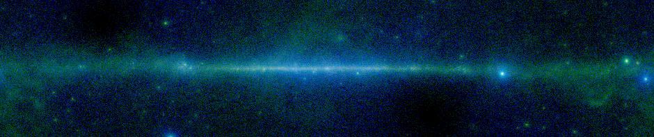
We have updated the VLA FIRST data to include many new observations made available at the MAST archive. These are available immediately at our web site. If you would like to use the new data using SkyView-in-a-Jar please download the latest SkyView jar file.

Posted in Notices | Tagged | Leave a comment

SkyView Main Page Update

SkyView Survey Data Status Table

SkyView Survey Data Status Table

You may have noticed that the SkyView homepage has changed. We wanted to add a new feature and decided it was time for a little re-arranging.

The new feature is a table listing SkyView local and remote surveys and their current availability status. Most survey data used for image generation are stored locally on SkyView systems but when images are generated from surveys  listed in this table the data are transferred from remote servers. From time to time data availability (both local and remote) is interrupted and image queries fail. We monitor these remote server connections throughout the day. If there are connection issues we update the table and try to notify our contacts at the appropriate institution as soon as possible.

Posted in Discussion | Leave a comment

Swift BAT 70 Month Survey Available in SkyView

A new release of the Swift BAT all sky survey is now available. This has data from the first 70 months of the Swift mission. It is much more sensitive than the 9 month surveys that we had heretofore. Both signal to noise and flux maps are provided. In the web interface flux maps are provided as links off of SNR map results, but both sets of maps are available directly through the batch interfaces. This is the inverse of what we used to have, but the SNR maps seem the better map to use when asking the question of whether anything is being detected at a given location.

Data are now divided into 8 energy bands (compared to 4 before) and a combined SNR image is also available. The surveys available are:

Band

Energy (keV)

Frequency (EHz)
1

14-20

3.38-4.84
2

20-24

4.84-5.80
3

24-35

5.80-8.46
4

35-50

8.46-12.1
5

50-75

12.1-18.1
6

75-100

18.1-24.2
7

100-150

24.2-36.3
8

150-195

36.3-47.2
Sum (SNR only)

14-195

3.38-47.2

You can specify the survey using either the band or the energy range. E.g.,
BAT-SNR-1, BAT SNR 1, or BAT SNR 14-20 all reference the same data. To get a flux map, substitute Flux for SNR in any of the aliases above, e.g., BAT Flux 14-20.

Note that case is ignored in survey aliases.

Thanks to the BAT team for the data. If you would like access to the nine-month images please let us know.

Posted in Announce, Notices | Tagged , , | Leave a comment

Planck Now Available Through SkyView

SkyView now provides access to the Planck all-sky survey data in nine frequency bands from 30 to 857 GHz. Currently we are using the data as released by the Planck team–a single file for each band. This requires SkyView to read relatively large files and can take longer than the typical survey. We are looking at tiling the Planck data to enable more rapid response when users are interested in only a fraction of the sky.

Posted in Announce | Tagged , | 2 Comments

Planck data in SkyView

This week we will be adding all-sky surveys from the Planck mission to SkyView. Planck provides nine all-sky images in the range from roughly 30-1000 GeV. While many Planck science goals relate to cosmology, Planck’s resolution approaches that of IRAS, so that Planck images may be of interest for imaging the the far infrared. Planck has roughly twice the resolution and substantially higher sensitivity than WMAP at the frequencies over which they overlap. Planck data extends to almost an order of magnitude higher frequency than the ~100 GeV cutoff for WMAP and the higher frequency data has higher resolution. WMAP does extend to slightly lower frequencies than the longest wavelength data from Planck.

These new surveys represent the first release of Planck data. Data has been downloaded from the IRSA’s Planck archive.

Planck data is stored in SkyView as a single all-sky HEALPix image. For the high frequency data the data file is 600 MB which means that it can take a little while to query Planck images. The three lower frequency bands are a bit faster since they are only 1/4 the size. We will be looking at creating tiles for for the Planck data if the delays seem unacceptable.

The following images give the WMAP-W image and Planck 100 GHz image of the 10 degrees of sky at the Galactic Center. These are at roughly the same frequency. While there is excellent agreement between the two, the superior resolution of the Planck data is immediately apparent.

Congratulations to ESA and the Planck teams in Europe and the US for their very impressive results.

WMAP galactic center

WMAP-W image of the Galactic Center

Planck 100 GHz image of Galactic Center

Planck 100 GHz image of Galactic Center

Posted in Discussion, Notices | Tagged , , | 1 Comment

Gallery changes

We’re changing the way the User Image Gallery is organized so that you can use it more effectively. Previously we’d set up the gallery so that the last 9 images were on the first page, the previous nine on the next and so forth. It could be very difficult to get to specific gallery images if you didn’t remember the exact URL to them. Now we organize the gallery by date and you can easily jump to a specific day. If more than 20 gallery images are taken on a day, then there are multiple pages for the day. You can still browse the latest images, or you can jump to any date since we started the gallery on October 7, 2008.

There will be a day or two as things are reorganized when new gallery images may not appear. We apologize for the inconvenience and anticipate getting everything working soon.

Please let us know if you have any questions or suggestions. We hope this makes it easier for everything to use the often beautiful and sometimes perplexing images that you have saved.

Posted in Notices | Tagged | Leave a comment

Error accessing GRANT-SIGMA survey

A typo in the survey description had disabled the GRANT/SIGMA survey. This is now fixed. I apologize for the error.

Posted in Notices | Tagged , , | Leave a comment

SkyView access to UKIDSS survey data

SkyView users may now generate images using the public UKIRT Infrared Deep Sky Survey (UKIDSS) data. While UKIDSS data is available in only a fraction (14%) of the sky, it goes much deeper and has higher resolution than the 2MASS data in the same wavebands. E.g., here is a comparison of 3-color images of the Galactic Center region (1000 pixels with a 0.1 degree field of view) in 2MASS and UKIDSS generated by straightforward SkyView requests (using a Clip resampler is the only non-default).

Galactic Center: 2MASS

A 3-color image of the Galactic Center in 2MASS KHJ colors

Galactic Center: UKIDSS

A 3-color image of the Galactic Center in UKIDSS KHJ

It’s easy to see how much deeper the UKIDSS data goes. SkyView uses the latest public release for the UKIDSS data. This is the DR8 release for most of the sky, and the DR7 for the UKIDSS Galactic Plane Survey. Many thanks to the UKIDSS team including Mike Read and Mark Holliman in setting up access for us. UKIDSS coverage is different in the different bands while the survey is ongoing and the Y band coverage will always be limited.

UKIDSS data is served by the Wide Field Astronomy Unit (WFAU) at the Institute for Astronomy in the University of Edinburgh. SkyView accesses the data using the Virtual Observation Simple Image Access protocol and caches images as users request them. As the cache of images at SkyView grows the time to generate images will diminish.

Internally UKIDSS data required that SkyView add support for the ZPN, zenithal polynomial, projection which is what UKIDSS uses. Another article will discuss use of the ZPN projection.

Posted in Announce | Tagged , , , , | 2 Comments

SkyView support for ZPN projection

As part of integrating UKIDSS data into SkyView, we have added support for the Zenithal Polynomial, ZPN, projection. In this projection the angular distance between a point on the sky and the reference position is transformed to a distance from the center of the projection plane using an arbitrary polynomial where the polynomial may be of any order up to 20. For UKIDSS a third order polynomial is used (but the second order term is nil). The azimuth of the point with respect to the reference position is preserved. Users may be more familiar with other azimuthal projections like the TAN and SIN projections where the projected distance is a trigonometric (tangent or sine respectively) rather than polynomial function of the distance on the sphere.

The ZPN projection is now fully supported for both input — the projection used in survey source images — and output — the projection users request. The ZPN projection is the first projection supported in SkyView where additional parameters beyond the reference coordinates are needed to define the projection. For input images, these parameters are looked for as the values for PROJPn keywords in the FITS header. On output users may specify _PROJPn settings (note the leading underscore).

One aspect of the implementation of the ZPN projection may be of note. The inverse projection is generally not soluble algebraically and is done using an iterative procedure, so that transformations from the ZPN plane to the sphere are less efficient than from the sphere to the plane. In a typical request, SkyView will transform from the user projection plane, into a standard reference system on the sphere and then into the projection plane of the source data. So the ZPN projection will be a bit more efficient as an input projection than for output.

We have not added fields in our query web forms that allow users to specify the projection parameters, but users can set these in GET or POST requests to the web interface.

In general if you would like to see support for a projection (or coordinate system) in SkyView which is not already there, please let us know.

Posted in Discussion, releases | Tagged , , , | Leave a comment

WMAP data accessible using SkyView Jar

We’ve made a small change to the way the WMAP data is described to allow it to be accessible either through the standard Web interface or to remote users using our SkyView Jar.

Access isn’t quite the same as for most surveys. Normally when you access a SkyView survey using the jar, any raw files you want are downloaded and cached on your machine. That allows subsequent queries to run much faster. The WMAP data is treated rather like the DSS datasets. You can access it over the web using the SkyView jar, but no caching will be done.

The reason is similar to what happens in the DSS. Our caching framework assumes standardish FITS images, i.e., a 2 or 3 dimensional pixel array in the primary header of a FITS file. Each DSS image is broken up into hundreds of image tiles. The WMAP data uses HEALPix images where the pixels are stored as a table rather than an image. The caching code can’t handle these image types. If this is something you’d like to see, let us know and we can look at supporting caching for these surveys.

One other survey is not available at all through the jar. The Mellinger surveys are not public and so we do not distribute raw data for these at all so the jar cannot access the raw Mellinger data when run remotely.

Posted in Discussion | Tagged , , , | Leave a comment